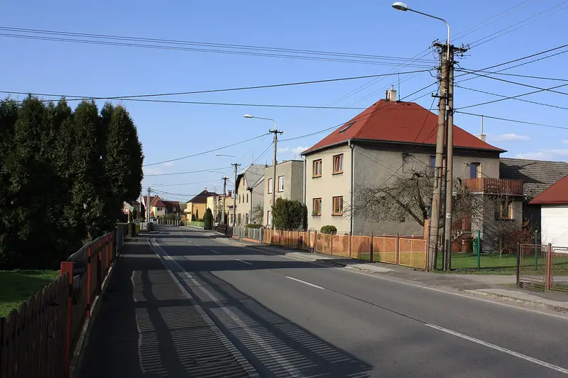
Antošovice, Ostrava
An Ostrava neighbourhood in the city district Slezská Ostrava · 0,4 km²
Rent
There were few rental offers in the neighbourhood, so the estimate is less precise.
All flat sizes
| Monthly | New build | |
|---|---|---|
| 1+kk, 1+1 · 36 m² |
6 300 Kč
176 Kč/m²
|
7 700 Kč
213 Kč/m²
|
| 2+kk, 2+1 · 55 m² |
9 400 Kč
171 Kč/m²
|
11 600 Kč
210 Kč/m²
|
| 3+kk, 3+1 · 70 m² |
12 000 Kč
172 Kč/m²
|
14 900 Kč
213 Kč/m²
|
| 4 rooms or more · 83 m² |
14 900 Kč
180 Kč/m²
|
22 600 Kč
272 Kč/m²
|
How we calculate it, and sources
Rent without services and energy for an unfurnished flat over 5 years old in good condition, without a balcony or parking, from rental offers. The Ministry of Finance’s rent map is per cadastral area: a neighbourhood has the figures of the area most of its addresses lie in. Monthly = price per m² × the usual floor area of rented flats in the Moravian-Silesian Region. Ostrava = the neighbourhoods’ average by population. Actual rents vary with condition, furnishing and floor.
Source: Ministry of Finance, rent price map (Act No. 151/1997 Coll., Decree No. 456/2024 Coll.), data up to 6/2026.
Transport
Where do you commute to? Work out your trip to work or school
Trams, buses, trolleybuses and night lines
How we calculate it, and sources
A typical trip from an address in the neighbourhood: walk to the best stop and on by DPO tram, trolleybus or bus or a regional ODIS bus or train arriving at Náměstí Republiky between 7:30 and 8:30 on a working day, without waiting for the first connection.
Source: the timetables of Dopravní podnik Ostrava and the regional ODIS buses and trains from the national timetable system CIS JŘ (Ministry of Transport, trains Správa železnic), stop positions: Zastávky MHD, City of Ostrava (CC BY 4.0), stations © OpenStreetMap contributors. We match stops to the neighbourhood by the nearest address.
The neighbourhood and its schools on the map
Catchment schools
Primary schools
A shared school district: any of its 4 schools.
Nursery schools
A shared school district: any of its 4 schools.
From the City of Ostrava’s map of school districts (CC BY-SA 4.0). An address’s catchment school depends on where in the district it lies.
Schools and kindergartens in the neighbourhood
Nursery schools (0)
None in this neighbourhood.
Primary schools (0)
None in this neighbourhood.
Secondary schools (0)
None in this neighbourhood.
Parks and forests
How we calculate it, and sources
Parks (from 0.2 ha) and forests (from 1 ha) according to OpenStreetMap. We measure the straight-line distance from every address in the neighbourhood to the nearest park or forest and show the median; the share is the area of parks and forests inside the neighbourhood’s boundary.
Doctors and pharmacies
| Places | Per 1,000 residents | |
|---|---|---|
| Paediatrician | 0 | – |
| GP | 0 | 0.00 · Ostrava 0.52 |
| Dentist | 0 | 0.00 · Ostrava 0.73 |
| Gynaecologist | 0 | 0.00 · Ostrava 0.22 |
| Pharmacy | 0 | 0.00 · Ostrava 0.29 |
How we calculate it, and sources
Contracted = the practice has a contract for that specialty with a health insurer and insurance pays for the care; we name the insurers from the lists published by VZP, ČPZP and VoZP. No contract = no insurer has a contract with it and you pay yourself. A practice without a label works with an insurer that doesn’t publish a list (OZP, ZPŠ, ZPMV or RBP); check the contract with them.
We count the places where care is given (surgery, polyclinic, hospital), not single doctors, per 1,000 residents in the 2021 census; Ostrava = the whole city. Paediatricians per child cannot be counted per neighbourhood. The nearest places are measured in a straight line from the neighbourhood’s centre.
Source: National Register of Healthcare Providers (ÚZIS ČR), lists of contracted providers of VZP, ČPZP and VoZP.
Nightlife
| Places | Addresses within 500 m | |
|---|---|---|
| Bars and pubs | 0 | 0 % · Ostrava 45 % |
| Clubs | 0 | 0 % · Ostrava 6 % |
How we calculate it, and sources
Bars, pubs, beer gardens and clubs according to OpenStreetMap.
Shops and services
All shops and services
| Places | Addresses within 500 m | |
|---|---|---|
| Supermarkets | 0 | 0 % · Ostrava 35 % |
| Corner shops, greengrocers, butchers | 0 | 0 % · Ostrava 51 % |
| Bakeries and pastry shops | 0 | 0 % · Ostrava 22 % |
| Drugstores | 0 | 0 % · Ostrava 13 % |
| Places | Addresses within 500 m | |
|---|---|---|
| Restaurants | 0 | 0 % · Ostrava 61 % |
| Cafés | 0 | 0 % · Ostrava 20 % |
| Fast food | 0 | 1 % · Ostrava 23 % |
| Places | Addresses within 500 m | |
|---|---|---|
| Post offices | 0 | 0 % · Ostrava 24 % |
| Cash machines and banks | 0 | 0 % · Ostrava 24 % |
| Libraries | 0 | 0 % · Ostrava 15 % |
| Places | Addresses within 500 m | |
|---|---|---|
| Playgrounds | 0 | 0 % · Ostrava 58 % |
| Gyms and fitness | 0 | 0 % · Ostrava 8 % |
| Sports grounds and pools | 0 | 0 % · Ostrava 24 % |
| Dog parks | 0 | 0 % · Ostrava 6 % |
| Cinemas and theatres | 0 | 0 % · Ostrava 10 % |
How we calculate it, and sources
We count places from OpenStreetMap and the share of addresses with at least one such place within 500 m as the crow flies (about 6 minutes on foot). OpenStreetMap is filled in by volunteers, small shops and new businesses may be missing.
Source: © OpenStreetMap contributors, ODbL licence.
What residents say
Write a reviewWhat is life like in Antošovice? Rate it in 30 seconds
Antošovice has no reviews yet. Be the first to help others.