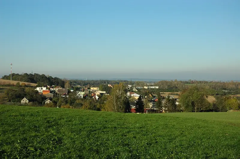
Koblov, Ostrava
An Ostrava neighbourhood in the city district Slezská Ostrava · 5,7 km²
Rent
There were few rental offers in the neighbourhood, so the estimate is less precise.
All flat sizes
| Monthly | New build | |
|---|---|---|
| 1+kk, 1+1 · 36 m² |
7 000 Kč
195 Kč/m²
|
8 800 Kč
244 Kč/m²
|
| 2+kk, 2+1 · 55 m² |
8 400 Kč
153 Kč/m²
|
10 600 Kč
193 Kč/m²
|
| 3+kk, 3+1 · 70 m² |
11 900 Kč
170 Kč/m²
|
15 100 Kč
215 Kč/m²
|
| 4 rooms or more · 83 m² |
17 800 Kč
215 Kč/m²
|
22 600 Kč
272 Kč/m²
|
How we calculate it, and sources
Rent without services and energy for an unfurnished flat over 5 years old in good condition, without a balcony or parking, from rental offers. The Ministry of Finance’s rent map is per cadastral area: a neighbourhood has the figures of the area most of its addresses lie in. Monthly = price per m² × the usual floor area of rented flats in the Moravian-Silesian Region. Ostrava = the neighbourhoods’ average by population. Actual rents vary with condition, furnishing and floor.
Source: Ministry of Finance, rent price map (Act No. 151/1997 Coll., Decree No. 456/2024 Coll.), data up to 6/2026.
Transport
Where do you commute to? Work out your trip to work or school
Trams, buses, trolleybuses and night lines
How we calculate it, and sources
A typical trip from an address in the neighbourhood: walk to the best stop and on by DPO tram, trolleybus or bus or a regional ODIS bus or train arriving at Náměstí Republiky between 7:30 and 8:30 on a working day, without waiting for the first connection.
At night we calculate the trip from Náměstí Republiky leaving between 0:30 and 1:30 on a weeknight, including waiting for the night connection and the walk home.
Source: the timetables of Dopravní podnik Ostrava and the regional ODIS buses and trains from the national timetable system CIS JŘ (Ministry of Transport, trains Správa železnic), stop positions: Zastávky MHD, City of Ostrava (CC BY 4.0), stations © OpenStreetMap contributors. We match stops to the neighbourhood by the nearest address.
The neighbourhood and its schools on the map
Catchment schools
Primary schools
A shared school district: any of its 4 schools.
Nursery schools
A shared school district: any of its 4 schools.
From the City of Ostrava’s map of school districts (CC BY-SA 4.0). An address’s catchment school depends on where in the district it lies.
Schools and kindergartens in the neighbourhood
Nursery schools (1)
-
Mateřská škola Slezská Ostrava, Zámostní 31, příspěvková organizace
Keramická 230/8, Muglinov, 712 00 Ostrava
Primary schools (0)
None in this neighbourhood.
Secondary schools (1)
-
AGEL Střední zdravotnická škola a Vyšší odborná škola zdravotnická s.r.o.
Private
Antošovická 107/55, Koblov, 711 00 Ostrava
Parks and forests
How we calculate it, and sources
Parks (from 0.2 ha) and forests (from 1 ha) according to OpenStreetMap. We measure the straight-line distance from every address in the neighbourhood to the nearest park or forest and show the median; the share is the area of parks and forests inside the neighbourhood’s boundary.
Doctors and pharmacies
| Places | Per 1,000 residents | |
|---|---|---|
| Paediatrician | 0 | – |
| GP | 0 | 0.00 · Ostrava 0.52 |
| Dentist | 0 | 0.00 · Ostrava 0.73 |
| Gynaecologist | 0 | 0.00 · Ostrava 0.22 |
| Pharmacy | 0 | 0.00 · Ostrava 0.29 |
Nearest to the neighbourhood’s centre: Paediatrician
- MUDr. Jana Zvolská contracted · VZP, ČPZP, VoZP · 2.7 kmU Nemocnice 837/2, 725 29 Ostrava
Nearest to the neighbourhood’s centre: Pharmacy
- Mgr. Marcela Schaffartziková, Lékárna Petřkovice · 2.4 kmHlučínská 17/254, 725 29 Ostrava
How we calculate it, and sources
Contracted = the practice has a contract for that specialty with a health insurer and insurance pays for the care; we name the insurers from the lists published by VZP, ČPZP and VoZP. No contract = no insurer has a contract with it and you pay yourself. A practice without a label works with an insurer that doesn’t publish a list (OZP, ZPŠ, ZPMV or RBP); check the contract with them.
We count the places where care is given (surgery, polyclinic, hospital), not single doctors, per 1,000 residents in the 2021 census; Ostrava = the whole city. Paediatricians per child cannot be counted per neighbourhood. The nearest places are measured in a straight line from the neighbourhood’s centre.
Source: National Register of Healthcare Providers (ÚZIS ČR), lists of contracted providers of VZP, ČPZP and VoZP.
Nightlife
| Places | Addresses within 500 m | |
|---|---|---|
| Bars and pubs | 0 | 0 % · Ostrava 45 % |
| Clubs | 0 | 0 % · Ostrava 6 % |
How we calculate it, and sources
Bars, pubs, beer gardens and clubs according to OpenStreetMap.
Shops and services
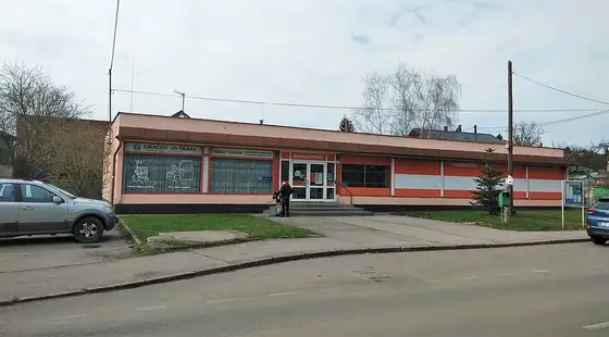
All shops and services
| Places | Addresses within 500 m | |
|---|---|---|
| Supermarkets | 0 | 0 % · Ostrava 35 % |
| Corner shops, greengrocers, butchers | 0 | 0 % · Ostrava 51 % |
| Bakeries and pastry shops | 0 | 0 % · Ostrava 22 % |
| Drugstores | 0 | 0 % · Ostrava 13 % |
| Places | Addresses within 500 m | |
|---|---|---|
| Restaurants | 1 | 45 % · Ostrava 61 % |
| Cafés | 1 | 11 % · Ostrava 20 % |
| Fast food | 2 | 9 % · Ostrava 23 % |
| Places | Addresses within 500 m | |
|---|---|---|
| Post offices | 0 | 0 % · Ostrava 24 % |
| Cash machines and banks | 0 | 0 % · Ostrava 24 % |
| Libraries | 0 | 0 % · Ostrava 15 % |
| Places | Addresses within 500 m | |
|---|---|---|
| Playgrounds | 1 | 21 % · Ostrava 58 % |
| Gyms and fitness | 0 | 0 % · Ostrava 8 % |
| Sports grounds and pools | 0 | 0 % · Ostrava 24 % |
| Dog parks | 1 | 19 % · Ostrava 6 % |
| Cinemas and theatres | 0 | 0 % · Ostrava 10 % |
How we calculate it, and sources
We count places from OpenStreetMap and the share of addresses with at least one such place within 500 m as the crow flies (about 6 minutes on foot). OpenStreetMap is filled in by volunteers, small shops and new businesses may be missing.
Source: © OpenStreetMap contributors, ODbL licence.
What residents say
Write a reviewWhat is life like in Koblov? Rate it in 30 seconds
Koblov has no reviews yet. Be the first to help others.